Showing posts with label Boise. Show all posts

Thursday, August 31, 2023

Oodles of Idaho outdoor fun await for Labor Day weekend! Might be a little wet, tho!

Drew Stuebner on a hike with Dad to Bridal Veil Falls in the Sawtooths. 

Hi all,

Labor Day weekend is upon us! It's the typical last hurrah of the camping season, so I'm dishing up some last-minute tips for the three-day weekend, as always. 

Before we get into the camping ideas, Bogus Basin, Brundage Mountain and Tamarack Resort all have some fun stuff going on this weekend, and the Spirit of Boise Balloon Classic at Ann Morrison Park runs daily through Sunday.  

Courtesy Spirit of Boise Balloon Classic
 
Steve fishing Rainbow Lake in the Trinities 

Now, on to the camping tips and other Labor Day ideas ... mountain weather  BTW looks a bit topsy-turvy Saturday-Monday with a good chance of thundershowers and high temps in the 60s. So make sure you've got a good rain tarp and dress warm! 

Recommended camping options: 
  • Trinity Mountains - Go camping, day-hiking or backpacking in the Trinities. I recommend driving there via Featherville. Head for Big Trinity Lake, the trailhead and general dispersed camping area. It's definitely worth backpacking into the high mountain lakes to get away from the car-campers and enjoy some good fishing!

  • Cascade area - Stolle Meadows and Landmark are my favorite camping areas in this neck of the woods. There are tons of primitive car-camping spots in both locations, east of Cascade, off the Warm Lake Highway. I've heard there may be some construction on the South Fork Salmon River Road? Plus, there are hot springs in the vicinity.
  • Lick Creek area in the Payette National Forest 

  • McCall area - Camping, hiking and backpacking in the Lick Creek area NE of McCall should be fabulous. Some of the nice mountain lakes up there include Box, Snowslide, Duck, Hum, Enos and Thirty-three lakes. Pick up a Payette National Forest map or a McCall Adventure Map to get the details for access. Also, check my blog from earlier this summer on five easy-to-access kid-friendly mountain lakes in the McCall area. 
    Stanley Lake beach 

  • Stanley area - I'm sure the Stanley area will be hopping with lots of campers at Stanley Lake, Redfish Lake, Pettit Lake and points along the Salmon River. 
    North and Middle Forks of the Boise River ... car-camping mecca 
  • Idaho City area - The North and Middle Forks of the Boise River work great for car camping. See my post from last week.  
  • Salmon River beaches - Upstream from Riggins along the Salmon River Road are many sweet spots for camping, hanging out and swimming. 
Salmon River beaches are the best in bare feet! Courtesy Winding Rivers Rafting

Also, Labor Day weekend is chock full of big sales at your favorite outdoor retailers in the Boise area, places like Idaho Mountain Touring, George's CyclesBoise REI, Greenwood's, McU Sports, Alpenglow Mountain Sport and Idaho River Sports. They all have some fantastic clothing and gear on sale right now. Great deals! Go get 'em! 
- SS

Thursday, November 12, 2020

Six destinations near Boise for a boot hike, xc ski, snowshoe in the snow!

Deer Point service road leading to the Boise Ridge Road (taken 11-11-20)

Hi all, 

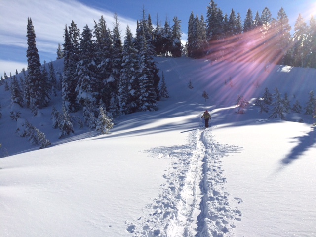
In less than a week's time, we've had an amazing amount of snow piling up in the Idaho mountains! Wendy and I went for a boot hike on the Deer Point service road on Wednesday afternoon (11-11), and we were amazed to be walking through nearly a foot of snow as we neared the high saddle between Deer Point and the Boise Ridge. 

The Mores Creek snowtel site shows 12 inches of snow at Mores Creek Summit, and there's at least 3-6 inches around McCall and Stanley, depending on elevation. Snow is beginning to build in the mountains, and starting tonight, there's a huge base-making storm descending on Idaho that could dump another 1-2 feet of snow in the Boise Mountains, West Central Mountains and Central Mountains. Woo hoo! 

Read my latest post in OpenSnow.com that details the weekend storm. 

Our snow hike yesterday just felt really invigorating on a sunny but brisk afternoon. The temperatures were in the low 20s. No wind. The late-afternoon sun created a cobalt-clear postcard sky with heavily snow-flocked trees in the background. Just gorgeous! 

Wendy and I are from the Midwest originally, so we always are eager to get out and play in the snow after the first significant snow storm. The Deer Point road is one of the best places to go boot-hiking, snow-shoeing, or xc skiing to access the Boise Ridge and enjoy a backcountry experience just a few minutes away from Bogus Basin Mountain Resort. The parking area is near mile 13 on Bogus Basin Road. Good place for dogs, too.

My outdoor tip this week highlights five other destinations where you could take a walk in the snow in the greater Boise area.

1. Bogus Basin Nordic Highway and Mores Mountain - The front side of Bogus Basin ski area is off-limits to backcountry skiers/snowshoers (see message here). People are being directed to the Nordic Highway, which is perfect for xc skiing and snowshoeing. Drive to the Nordic lodge to begin your adventure. Backcountry skiers are being steered to Superior, Pine Creek and Mores Mountain. 

New trail leading from BB Road over to Sweet Connie/Stack Rock jct. About 3 miles one-way.

2. New trail to Sweet Connie/Stack Rock - Park at the pullout on Bogus Basin Road (near mile 10) and take the new trail going over to Sweet Connie and Freddy's Stack Rock Trail. Good place for an out-and-back boot hike. Snowshoes will be suitable after the snow gets deeper. Dogs are A-OK.

3. Mores Creek Summit - Take Idaho 21 to Idaho City and continue to Mores Creek Summit, trailhead for Pilot Peak and Sunset Mountain. This is a popular spot for snowmobile riders going up to Pilot Peak and backcountry skiers and snowshoers. Also a fun spot for kids to play in the snow in the parking lot. Both of the snow roads taking off from Mores Creek summit are steep and continuous, but definitely doable. 


4. Idaho City Park n Ski areas - Idaho Parks and Recreation officials said that grooming won't start until December 1st in the park n ski areas, but anyone could still break their own trail at any of the trailheads. After Friday's storm, the park n ski parking lots may not be plowed until Saturday ... you might call the ITD shop in Idaho City to check on status.

5.  McCall/Bear Basin - People are skiing on the McCall Golf Course, and it should be possible to xc ski or snowshoe at Bear Basin as the snow gets deeper after Friday's storm system passes through. If you were thinking about skinning up Brundage Mountain, Brundage officials have specific guidance on skinning hours at the resort (before 9 a.m. or after 4:30 p.m.). See details here.

Have fun!
- SS

Thursday, December 5, 2019

Hot tips on where to play in the snow this weekend in SW Idaho

Grand Targhee will be celebrating Global Fat Bike Day on Saturday with free 1-hour rentals. (Courtesy Grand Targhee)
Free demo day at Galena Lodge on Saturday. (Courtesy Galena Lodge)
Hi all,

My, it has been a DREARY week for those of us stuck in the valley! Wake up to freezing ground fog, and hope things burn off for a little sunshine in the afternoon. Pretty grim.

Hopefully, all of you have been doing your snow dancing, sending good vibes to the Snow God Ullr.

A solid storm system is headed our way Friday night-Sunday, which is expected to dump 4-6 inches in the mountains, hopefully even more! Here's my OpenSnow post with the details on weekend weather and ski area openings and re-openings this weekend.

It's note-worthy to mention that Sun Valley will be opening the Warm Springs side of Bald Mountain on Saturday with the Challenger lift, providing more than 3,000 thigh-burning verts top to bottom. Ditto with the River Run side of the mountain, Upper College and Lower College. Sun Valley is offering reduced lift ticket and lodging prices prior to the Christmas season. Be sure to take advantage of that!

Photo for #BarrelyanEvent snowboard event this year. (courtesy Bogus Basin) _
It's also pretty cool that Bogus Basin is providing top-to-bottom skiing with man-made snow on Chair #1 Deer Point, plus you have the Terrain Park, some Nordic ski trails are open and the tubing hill is open. There's a snowboard event happening on Saturday. Be sure to make advance reservations to go tubing. More terrain will open as we get more snow.

Tamarack and Brundage will be operating their beginner lifts this weekend, but that's all until we get more snow. Did I say we need more snow~!!!! Skiing/riding is free at Brundage BTW.

Cross-country skiers might want to travel to the Wood River Valley this weekend to ski some groomed trails around Galena Lodge and in the Wood River Trail System. Galena Lodge is hosting a demo day on Saturday to give you a chance to try out new skis, boots and pools for Free!


The Blaine County Winter Trailink provides a quick glimpse of what xc and snowshoeing trails are open so far. The Harriman Trail is apparently skiing really well, north of the Sawtooth NRA trailhead, and there are a number of trails open around Galena Lodge.

There isn't enough snow in McCall for xc ski grooming yet, so stay tuned on that.

Closer to Boise, watch the Ridge to Rivers Facebook page for the latest conditions. It's touch-and-go on most trails right now except on the all-weather trails, and if it rains this weekend in the valley (snow up high), the lower foothills trails will be muddy and gummy. Please stay off muddy trails.

Boot hiking? Family crew hiking Freddy's Stack Rock Trail over to Sweet Connie.
Book hiking is another possibility this weekend on the service road to Deer Point or perhaps the Eastside Trail or the new Freddy's Stack Rock trail above the snowline. We boot-hiked Freddy's on Thanksgiving Day. It had several inches of snow on a frozen surface ... perfect!

Road trip? In case you haven't heard, the skiing/riding in Utah is pretty darn good already! Wasatch Resorts are reporting summit bases in the 50-60 inch range. More snow is expected this weekend! The skiing/riding is decent at Grand Targhee, too, right now ... they're celebrating Global Snow Bike Day on Saturday, with 1-hour free rentals.  


Have fun!
- SS

Thursday, May 15, 2014

Try hiking or riding Avimor trails ... moderate, twisting, fun singletracks for all abilities

Lots of trails, blue sky and open space at Avimor 
Mike Edwards, President of SWIMBA, operates the ST-240 trail-cutting machine at Avimor.
Photo courtesy Idaho Statesman

Volunteers buff out the trails at Avimor

Big bridge project turns out very nice! 
Hey all,

It's been fun to watch the new hiking, biking and horseback trails evolve, improve and expand at Avimor, a budding housing development with lots of open space located a few minutes north of Boise on Idaho 55. I went out there last Sunday with John Wheaton, Amy Haak, and Scott Perryman from the Southwest Idaho Mountain Biking Association (SWIMBA) and got a personal tour of some of John's favorite trails and some of Scott's recent handiwork on the ST-240.


When I was updating the latest edition of Mountain Biking in Boise several years ago, I rode a cool short loop featuring a super-fun downhill along Spring Valley Creek, and I also featured the Coyote Classic sport and expert loops at Avimor, and a challenging long loop to Sheep Rock, located several thousand vertical feet above the valley floor. Both of those rides ended up in my book.

Since that time, SWIMBA has been working to expand Avimor's trail system through hundreds of hours of sweat equity, and they have their new ST-240 trail-cutting machine that they've been putting to use as well! Here's an overview map of their trail system with details about each trail.

What I enjoyed about our ride on Sunday was that we stayed in the lower to mid-range foothills the whole time, exploring all kinds of different singletrack trails. The trails we climbed were moderate, not that steep. It seems that the Boise Foothills don't have very many moderate trails except in Military Reserve and Polecat Gulch ... I feel for the beginning and intermediate riders when they complain that all the trails in the foothills "go straight up!"

Last Sunday, we started at the Avimor trailhead by the tennis courts and rode the following circuit:

  • Up Broken Horn Road to Baun's Eye Trail #15 and then Broken Horn Trail #12 and climbed to the saddle above Spring Valley Creek. 
  • Dropped down to the Spring Valley Creek Trail #9 junction (be sure to cross the creek first, and then the trail peels off to the left), and zoomed down Spring Valley Creek Trail. Tons of fun. Be sure to watch for other trail users coming up the trail. 
  • Took Shooting Range Trail over to Bovine Nirvana, rode a new trail yet to be named that Scott had put in recently with the ST-240 and then came back on Shooting Range and Twisted Spring Trail. 
All told, we rode about 12.5 miles over three hours at a leisurely pace. Exploring the trails at Avimor is much easier now because they have trail maps at the clubhouse, and many of the trail junctions are marked with trail signs. I recommend exploring the area if you like to hike or ride horseback, too.

Pack some food, water and sun screen and enjoy the beautiful May weather!

BTW, if you'd like to help SWIMBA enhance the trail system at Avimor, there is a work day planned on Saturday with Broken Spoke Cycling. People are meeting at 8:30 a.m. at the park. Turn left at the T-junction as you come into the community, and park by the tennis courts.

Have fun!
- SS

Monday, March 2, 2009

Early Spring Hikes Guaranteed to Please

Jumpin' Jeepers Figure 8 Loop,
Military Reserve Park
6.75 miles

Wildcat Canyon Loop,
3.4 miles, south of Marsing

The Bruneau Dunes rise 470 vertical feet.
It's a nice perch lording over the Snake Plain

Jump Creek Canyon


Wow. Monday afternoon nudged 70 degrees in Boise on March 2. Makes you think about spring.

For the tip of the week, we flip-flop from powder skiing to some sure-fire spring hikes that should work great in March and April. All of these are within an hour's drive of Boise.

1. Go hiking above Jump Creek Canyon, south of Marsing on Cemetery Road, Owyhee Foothills.
2. Play in the sand at Bruneau Sand Dunes State Park, south of Mountain Home. Video here.
3. Surprise Valley-Oregon Trail Loop in East Boise.
4. Hillside to the Hollow in the Boise Foothills.
5. Hike to Wees Bar on the south side of the Snake River Canyon, starting from Swan Falls Dam (Follow directions on the Wees Bar link to Mountain Biking Idaho, which has a map and description of the 12-mile out-and-back hike). You also could float down there in a raft and take out at Celebration Park.
6. Hike to Halverson Lake, starting from Celebration Park, south of Nampa.
7. Hike the Wilson Creek - Reynolds Creek Loop, including the China Ditch Trail, in the Owyhee Foothills, near Walters Ferry, south of Nampa.
8. Tour Polecat Gulch in the NW Boise Foothills.
9. Scramble up Wilcat Canyon in the Owyhee Foothills. See map above. Beautiful box canyon loop close to home.
10. Do the Jumpin Jeepers Figure 8 Loop in Military Reserve Park, near Fort Boise. See above.

All of these trips are described in detail, with maps, descriptions and photos, in the Boise Trail Guide - 75 Hiking & Running Routes Close to Home by Steve Stuebner, published July 2008.

Have fun!

- SS

Sunday, February 8, 2009

Sweet slice of country in SW Boise


(Route map cropped from the "Boise Road Cycling Guide")

If you're a powder hound, this endless string of beautiful sunny days we've had lately is a bit depressing. But I learned long ago that in drought winters, you've simply got to adapt ... so on Saturday afternoon, I jumped on my road bike and rode a 28-mile country tour on the outskirts of Southwest Boise. It's really quiet out there, the pavement is in good shape, and the great big expanse of country makes it feel as though you're a long ways from town.

The route I took was a combination of George's Tuesday Night Ride and a few snippets of the Boise Half Century Ride for a two-hour ride (pretty major headwind). These rides are featured in a new waterproof bike map I published in December called the Boise Road Cycling Guide.

I started at the junction of Gowen and Pleasant Valley, and then rode south on Pleasant Valley. The southeast wind was right in my face on the way up the Pleasant Valley grade. Big gravel pits are peppered along the grade. At the top of the hill, I went right on Ten Mile Creek Road, a beautiful route along a ranch and creek bottom. Then, I went south on S. Cole to Kuna-Mora Road, again in the wind. But I had the route to myself ... no cars in sight for miles.

At Kuna-Mora, I turned right and rode several miles west into a warm afternoon sun. Then, heading north on Cloverdale, I had a nice tailwind and flew back toward Kuna at 22-25 mph. Instead of riding back over to Pleasant Valley via Ten Mile, I went straight on Cloverdale, and then cut over to S. Cole on Lake Hazel. There's a nice parkway along Lake Hazel east of Cloverdale. Lake Hazel comes to a dead-end, and then you turn left and ride on a couple of small streets in a subdivision to reach S. Cole.

Back into the blasted head wind, I rode S. Cole to the Peregrine Fund turnoff and turned left on Hollilyn for the home stretch back over to Pleasant Valley. There's a lot of open sagebrush between that southern bench and the Boise Airport. Great spot for mice, rabbits and hawks. I saw several red-tails patrolling low, just hovering above the ground.

Anyway, this country tour is a beauty. And it kicks your butt hard enough that you'll be hungry for dinner! Try it sometime. -SS

Saturday, February 7, 2009

Fair weather skiing at Bogus

Last Saturday, we had the privilege of skiing under sunny skies at Bogus Basin with a bunch of friends. I brought my video camera and took some shots as we yo-yo'd a great off-trail mogul slope to the skier's right of upper Paradise.

Here's a link to the video.

We all love to ski in the sunshine, but lately, I've been praying for snow. We need a fresh coating everywhere ... sounds like we might be getting the storms coming through this weekend, just in time for the Special Olympics World Winter Games. Bring it on! - SS

Sunday, January 18, 2009

My boyhood hockey rink still rocks

My boyhood outdoor hockey rink
Bennett Field, Deephaven, Minnesota
Free outdoor ice - Priceless!

I was back in Minnetonka, Minn., to hang out with my Dad over the weekend, and I had a little time Saturday afternoon to head over to Bennett field -- a place where I used to play hockey when I was a kid. Much to my delight, the outdoor rink was flooded, frozen and in good shape. Six juniors from Minnetonka High School had a pickup game under way.

I laced up my skates in the warming house and joined the game. We played for an hour until we were exhausted (no resting allowed). Much to my delight, I could hang pretty well with those boys. They loved hearing about how I had played in league hockey at that rink and others nearby in the late 1960s and early 1970s. Back then, below-zero temperatures were typical in January -- and my toes and fingers will never be the same.

It's too mild in Boise for consistent outdoor ice. So I really love it when I have a chance to play sandlot hockey in Minnesota. It's a treat. -SS

Sunday, January 11, 2009

Cartwright Three Summits Loop always delivers


After at least a week of melting conditions, the roads are dry again in the lower elevations surrounding Boise, so I thought it'd be a great chance to ride the Cartwright Three Summits Loop (also known as "the Dump loop") on Saturday afternoon.

It was a partly cloudy day, with temps in the high 30s, so I dressed warm and peeled out on my road bike toward Hill Road. It's easiest from my house in NW Boise to ride up N. 36th Street past Quail Hollow Golf Course to Arrowhead Point and connect to the first summit on Cartwright Road from there.

And then, there's the killer steep hill going up the second summit of Cartwright. It's always a punishing experience going up that 10% grade -- guaranteed to hurt.

At the top of the second summit, tho, you can really let it rip down to Pierce Park Road, bear right and climb over a short hill on brand new pavement to the Dry Creek Valley. It's mostly downhill through here, and you ride by Hidden Springs, turn left on Seamans Gulch Road and climb to the third summit. It's a fairly gradual climb to the Seamans summit, but your legs are a bit taxed by now, so it still hurts.

Once over the top, you zoom by the Ada County Landfill and the Seamans Gulch foothills trailhead, connect to Hill Road and bear left to return to the start.

The loop is about 17.5 miles, 18 from my house. Total vertical gain is 1,598 feet.

The ride is featured in the new Boise Road Cycling Guide, the first-ever road cycling map for 30+ rides in the greater Boise Valley. - SS

Monday, December 22, 2008

Sledding at Hilltop Summit

In snow sledding season, sometimes it's great to head out to your own favorite local sledding hill and go for it.

I've often taken my kids to a nice sledding hill near Hilltop Summit, near Lucky Peak Reservoir, about 12 miles east of Boise on Idaho 21. There's a turnout to the left, and you can climb the hill as many times as your legs will allow.

Here's some video of my 11-year-old son, Quinn, on the hill, and a few other characters.

-SS

Sunday, October 19, 2008

Sweet getaway to Birds of Prey Area via Swan Falls Road


It's been a while since I went out to the Snake River Birds of Prey National Conservation Area, and I needed to ground-proof travel time and mileage from Kuna to Swan Falls Dam and back on my road bike, so I went for it last Sunday. It's 21 miles each way.

There was a brisk NW wind -- it blew me out to the Snake River canyon in about an hour. I dreaded the headwind on the way back, but I figured if I could average over 20 mph on the way out, maybe I could average 10 mph on the way back. It wasn't that bad, actually, more like 13-16 mph, until the wind kind of dissapated in the late afternoon.

The ride from Kuna to the Birds of Prey area is cool. You'll see hawks soaring along the way, maybe eagles, falcons and hawks along the cliff's edge. From a road riding perspective, the road is nearly empty, so it's a great place to get away from traffic.

The 2-mile descent to the dam is quite steep, so you zoom down, knowing you'll have to climb back out of there on the way back. But it's doable in low gear. Seemed to be a 10 percent grade in places.

Travel time was 3 hours, including a stop at the BLM interpretive site at the canyon rim, a great place for lunch or a snack.

I must admit that during the ride, I thought about my friend Morley Nelson, who was most instrumental in protecting that canyon for birds of prey forever. Congress has been working on changing the name of the raptor sanctuary after Morley, and there is a grade school in Boise that's been named after Morley. I wrote a biography on the man, Cool North Wind, and he left a lifelong impression on me. I feel fortunate to have known him.

I saw a golden eagle flying low near the canyon rim, hunting at the sagebrush level, and I thought of Morley, knowing that his spirit will soar in the wind above the canyon forever.